
interjektio theme
Turn complex 3D data into instant insight
At Interjektio, we make reality data accessible. Our browser-based point cloud visualisation solutions run on any modern device—no licences, plugins, or powerful workstations needed. Just click a link and explore.
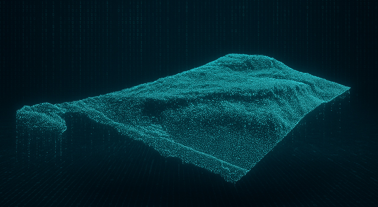
Point clouds are highly detailed 3D models of the physical world, created by laser scanning or drone mapping. They capture shapes, surfaces, and textures with great accuracy, offering more insight than traditional 2D maps or drawings.
Point clouds support many industries: infrastructure inspection, construction progress tracking, forestry and environmental monitoring, mining and quarry volume analysis, cultural heritage preservation, urban planning, and agriculture.
At Interjektio, we make 3D reality data easy to use. Our browser-based point cloud solutions run on any device—no licences, plugins, or heavy computers. Open a link, and the data is ready.
This approach makes 3D data accessible, collaborative, and cost-efficient. Teams can work on the same dataset, measure and annotate directly in the browser, and scale from small sites to entire cities without performance issues.
Our solutions differ from off-the-shelf tools. They are customisable to match specific workflows and built on open standards to ensure long-term reliability.
Instead of relying on expensive, complex software, our solution lets you view and share point clouds directly in a web browser. Anyone with a link can explore the data, zoom in on details, and take measurements without special training.
This makes collaboration easier. Engineers can check construction progress, planners can visualise future developments, and environmental experts can track changes over time—all from the same interactive dataset.
Point cloud visualisation helps industries work faster, reduce costs, and make better decisions. It improves accessibility, cuts down travel and software costs, and allows teams to focus on analysis instead of data handling.
At Interjektio, we support the full process: from preparing raw data to delivering ready-to-use interactive models, and embedding them into existing workflows.
Point clouds are no longer a niche tool—they are a practical and transformative way to understand the world. At Interjektio, we bring together expertise in 3D visualisation, web technologies, and spatial data to make this power usable for everyone.
Our platform is:
Simple – no specialised software or training required
Powerful – smooth and responsive, even with massive datasets
Customisable – shaped to fit your projects and workflows
Future-ready – built on open standards, designed to last
Interjektio turns reality into data, and data into insight. All directly in your browser.